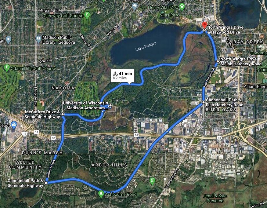

The route (8.2 miles) outlined below traverses a mixture of bicycle paths, city streets with bike lanes, and a quiet road through the U.W. Arboretum. It takes about 50 minutes for the average cyclist.
_________________________________________________________________________
Arboretum entrance to Fish Hatchery - .5 miles
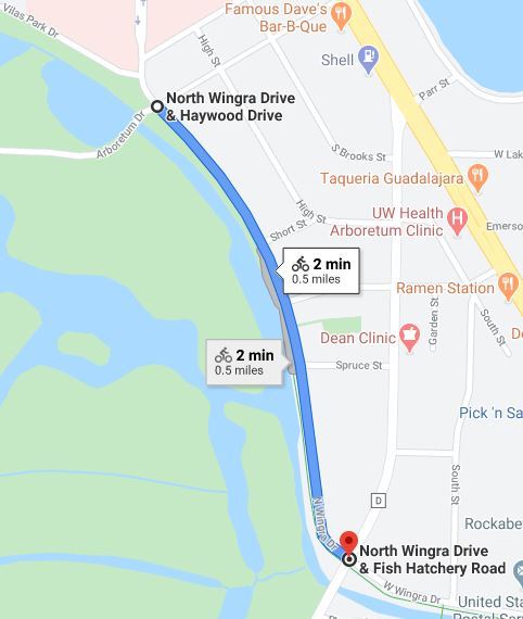
The starting point is the eastern entrance to the Arboretum at N. Wingra Drive & Haywood Drive. There is a BCycle station a few yards to the north of the entrance where you can rent an electric bicycle.
Take the Wingra Creek Bike Path south for a half mile to Fish Hatchery Road. The Wingra Creek Bike Path parallels Wingra Creek and the eastern edge of the Arboretum.
When you reach Fish Hatchery road you will be turning right. However if you went straight ahead, you would continue on the Wingra Creek Bike Path until you reach Olin-Turville park where you can connect with the Lake Monona Bike Path.
_________________________________________________________________________
Fish Hatchery - .6 miles
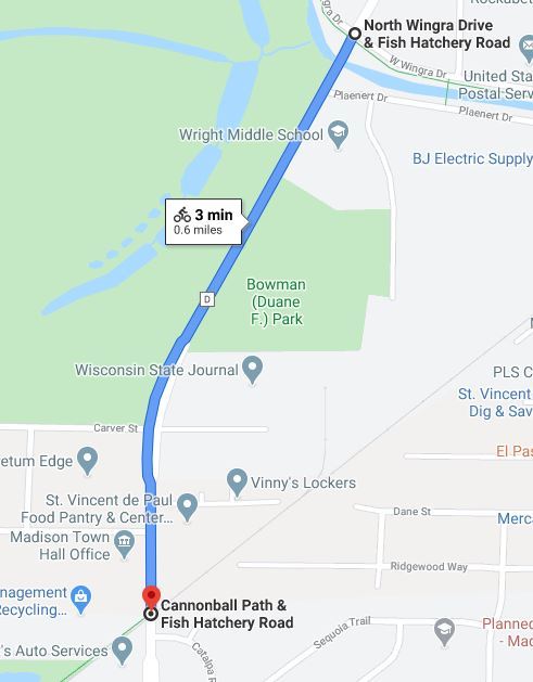
After turning right on Fish Hatchery Road you have two options: 1) using the bike lane on Fish Hatchery Road, or 2) biking on the sidewalk along the south side of Fish Hatchery Road if you feel uncomfortable using the bike lane because of the traffic. Proceed .6 miles and just before the railroad tracks you will see the start of the Cannonball Path on the right.
______________________________________________________________________
Cannonball Path - 2.8 miles

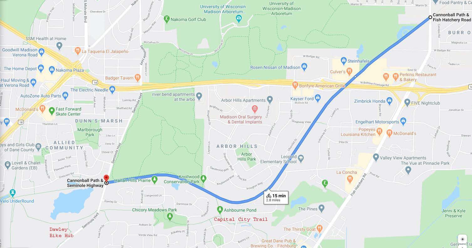
After turning right on the Cannonball Path, the Arboretum parallels the path on your right side for the next 2.8 miles. About a mile along the path you will reach a pedestrian/bicycle bridge crossing the beltline. Just before the bridge there is a Culvers on the right where you can get some ice cream and other refreshments.
Continuing on the Cannonball Path, after 1.5 miles you will see a kiosk on your right that marks the Knollwood Conservation Park and the Westview Bike path. A few yards along that path is the southeast entrance to the arboretum. Bicycles are not allowed on paths in the arboretum but you can park your bike and explore Greene prairie and Grady tract on foot.
Continuing on the Cannonball path, you will shortly arrive at the Seminole highway junction where you will be turning right. To the left of the Seminole highway junction is a dedicated bike path that will take you to the Capital City Trail and the Dawley Bike Hub. If you went straight ahead, the Cannonball path will take you, after one mile, to the Velo Underround, a junction of five trails: the Capital City Trail, the Southwest Commuter Trail, the Military Ridge State Trail, the Badger State Trail, and the Cannonball Path.
________________________________________________________________________
Seminole Highway - 1.0 miles

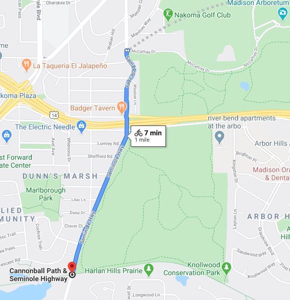
This one mile segment on Seminole highway has a bike lane and is hilly at the start until you reach the beltline overpass at the top. At the top on the right side before the overpass is an Arboretum parking lot where you can park your bike and explore the Grady Tract and Green Prairie. Continuing on Seminole highway, cross the overpass and bike down the hill until you reach the first right - the entrance to the Arboretum at McCaffrey Drive - turn right onto McCaffrey Drive.
_________________________________________________________________________
Arboretum - 3.2 miles

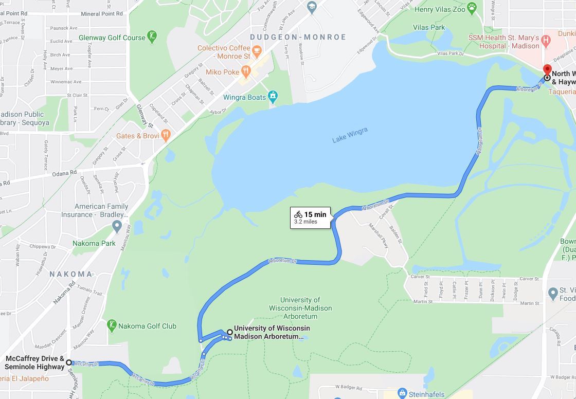
The final stretch goes through the University of Wisconsin Arboretum for 3.2 miles.
A mile into the Arboretum is the visitor center (closed now because of Covid-19). West of the visitor center is the Curtis Prairie, the world's oldest ecologically restored prairie. East of the visitor center is Longenecker Horticultural Gardens, the premier collection of trees, shrubs, and vines in Wisconsin. There are many opportunities in the Arboretum to explore trails on foot (bicycles are not allowed on the trails) by downloading a trail map.
From the visitor center take Arboretum Drive to the eastern Arboretum entrance. This road has light traffic allowing a very peaceful finish to the Cannonball Path/Arboretum loop.
_________________________________________________________________________
BCycle Station along the Route
At the start of the loop, there is a BCycle station near the eastern entrance to the Arboretum at 850 S. Mills.

_________________________________________________________________________
Other Resources
Dane County Bicycle Map
Madison BCycle
Madison Bikes Community (Facebook)
Madison Bikes
Bicycle Benefits
Top 10 Trails to Try in Madison
Biking in Fitchburg
The Ultimate Guide to Biking in Madison Wisconsin
Your Guide to the Lake Monona Bike Loop
_______________________________________________________________________
Compiled by Bob Shaw - robert.e.shaw@gmail.com
June 2020; updated June 2025